
Clouds are certainly eye-catching and beautiful, but they are also quite useful sometimes. And on some occasions, the best and the only weather forecast you have are clouds and sky itself.
Knowing the basic cloud types can make your predictions more accurate. Once you start observing clouds, eventually you learn to predict rain, storms, and weather generally, which is certainly a great skill for every adventurer.
Cloud types
A pharmacist and amateur meteorologist Luke Howard proposed the cloud classification in 1802. He introduced 10 basic cloud types, highest to the lowest: nimbostratus, stratus, cumulonimbus, cumulus, stratocumulus, altocumulus, altostratus, cirrocumulus, cirrostratus, and cirrus.
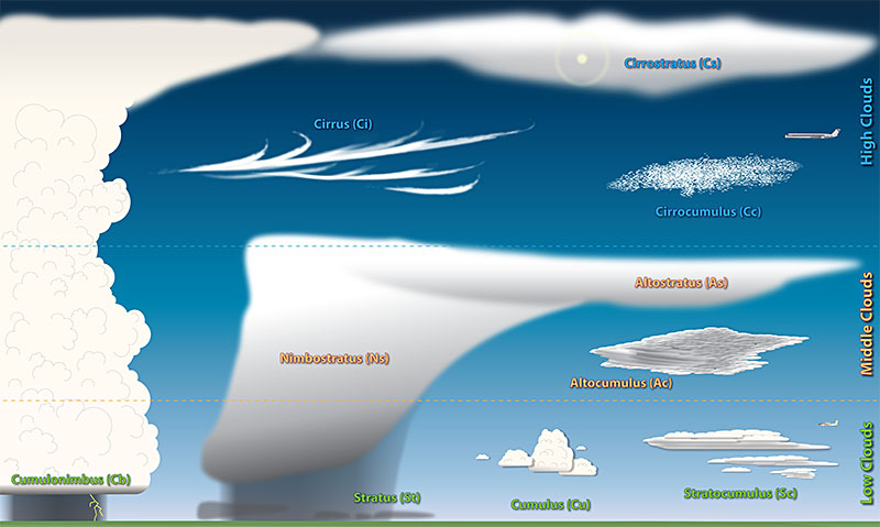
Source: noaa
So, which clouds should you be aware of when you’re planning a camping or a hiking and don’t want to get caught in a rain?
Rain clouds
How to recognize these clouds? What cloud transformations, appearance, and drifts may indicate the bad weather? Here is a list of rain clouds, so if you spot them maybe it’s better for you to stay at home. Or make sure you have proper camping items for rainy and damp weather.
Cumulonimbus
Height: up to 13.700 m (6,500 ft)
Location: Tropical and temperate regions, rarely in polar
How it looks: These dense low-level clouds look like a mountain or a tower with the top usually smoothed, fibrous or striated and it has the shape of an anvil or vast plume.
Indicates: Heavy downpours, hail, storms, thunders and lightning. When these huge dark gray clouds fulfill the entire sky, be prepare for extreme rain, thunders, and hail (they also produce tornados). They are the main culprit for the most dangerous weather conditions. Planes never fly through these clouds.
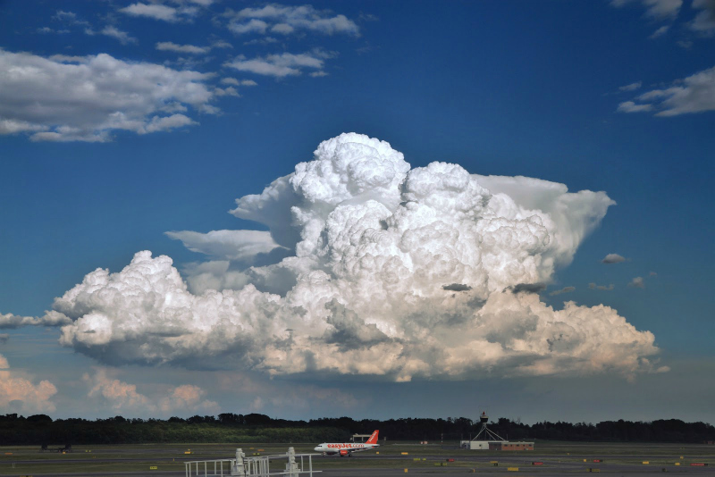
Cumulonimbus
Cumulus
Height: 600-900 m (1,900 – 6,500 ft)
Location: Worldwide, except Antarctica
How it looks: Large, white, fluffy, low-level clouds with different shapes – the bottom is usually flat but the top reminds of the cauliflower. When they reflect the sunlight, they look white, but when the Sun is behind them, they’re opaque and black.
Weather indications: Fair weather, but maybe a short shower. They don’t usually bring rain, but be cautious and observe carefully the clouds transformations. These clouds indicate fair weather when they are widely separated, but if they are large and many headed, or show vertical growth they can indicate the start of a large storm.

Cumulus
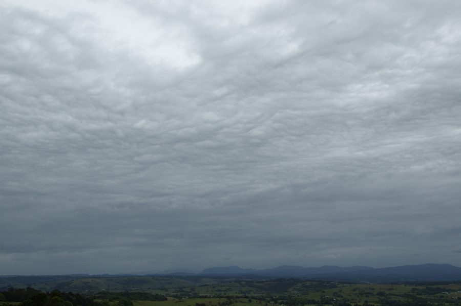
Nimbostratus
Height: 100-3,000 m (2,000 – 10,000 ft)
Location: Worldwide
How it looks: Thick, dark gray amorphous and solid clouds. You can’t see the Sun through them since they’re quite thick. Also, low, ragged edges and small cloud fragments frequently occur beneath this cloud which sometimes merges with its base.
Weather indications: Rain and snow. Unlike cumulonimbus, nimbostratus is not associated with thunderstorms. However, cumulonimbus clouds sometimes may be embedded within a nimbostratus.
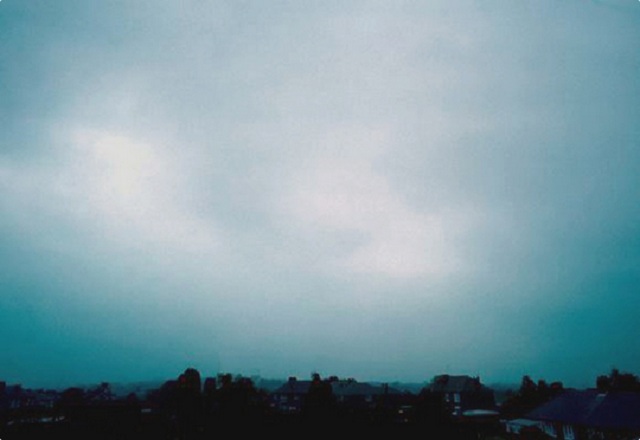
Nimbostratus
Non-rain clouds indicate bad weather too
Sometimes a cloud that looks harmless and innocent could bring bad weather. Keep an eye on these signs too:
Cirrus
Height: 5.000-13.000 km (16,600 to 40,000 ft)
Location: Worldwide
How it looks: They are high-level and thin clouds. They form silky, delicate, mostly white filaments and bands.
Weather indications: These clouds indicate fair weather. If they appear irregular and patchy, slowly shifting from easterly directions, often dissolving, they are indicating increasing high pressure and dry, sunny and quiet weather.
However, they can also be an indication of a change in weather patterns within the next 24 hours, especially if they are spreading out from the west or southwest, thickening into a denser sheet of cirrostratus.
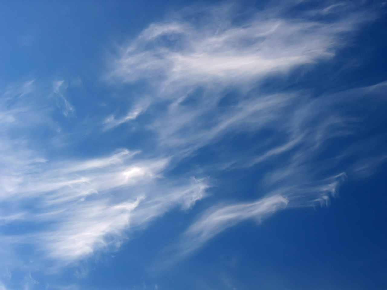
Cirrus
Altocumulus
Height: 2.000-7.000 m (6,500 – 20,000 ft)
Location: Worldwide
How it looks: Altocumulus is made of many beautiful, large, fluffy grayish-white patches or less separate cloudlets covering the entire sky. You can’t see the Sun through them.
Weather indications: If you see them in the morning, prepare for a thunderstorm in the afternoon.
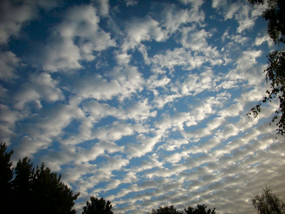
Altocumulus
Altostratus
Height: 2000-5,500 m (7,000 – 18,000 ft)
Location: Worldwide
How they look: They are easily classified due to their blue-gray color. They cover the whole sky. You can see the glow of the sun, but it can not make shadows through the thick mile long cloud.
Weather indications: They are the sign of inclimate weather and there are great chances to have some rain soon that day.
Altostratus
Plane contrails
It might sound strange but the white streaks that planes leave behind are actually artificial clouds. The only difference is they are man-made. The contrails can actually predict the weather just as accurate as some clouds. In temperate regions, if plane contrails spread in the sky – that is the sign of air pressure changes and temperature drafts. If contrails disappear quickly, it is a sign of stable, quiet and nice weather.
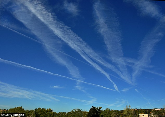
Plane contrails


