
NOAA’s new satellite GOES-16 has sent the stunning images of Earth at a higher resolution than previously possible.
The first spacecraft in NOAA’s next-generation of geostationary satellites, GOES-16 is of a huge importance – the satellite will allow meteorologists to see detailed features of the Earth’s atmosphere and weather systems. In this way, GOES-16 will warn meteorologists and scientists about the potentially hazardous weather.
According to NOAA’s press release, GOES-16 has the ability to target regional areas where severe weather, hurricanes, wildfires, volcanic eruptions or other high-impact environmental phenomena are occurring as often as every 30 seconds.
“The image is much more than a pretty picture, it is the future of weather observations and forecasting,” said Louis W. Uccellini, Ph.D., director, NOAA’s National Weather Service, Silver Spring.
“High-resolution imagery from GOES-16 will provide sharper and more detailed views of hazardous weather systems and reveal features that previous instruments might have missed, and the rapid-refresh of these images will allow us to monitor and predict the evolution of these systems more accurately. As a result, forecasters can issue more accurate, timely, and reliable watches and warnings, and provide better information to emergency managers and other decision makers”, Uccellini adds.
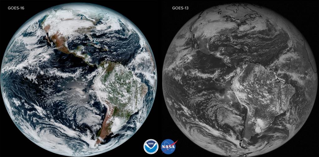
NOAA’s comparison of images from two different satellites, GOES-16 and GOES-13, captured at the same time on the same day: 1:07 p.m. EST on January 15, 2017. Credits: NOAA
The backbone of life-saving weather forecasts, GOES-16 satellite, launched on November 19, 2016, can provide incredibly sharp images. NOAA’s scientists are looking forward to exploiting these new images.
“Seeing these first images from this satellite is a foundational moment for the team of scientists and engineers who worked to bring the satellite to launch and are now poised to explore new weather forecasting possibilities with this data and imagery,” said Stephen Volz, Ph.D., NOAA’s assistant administrator for Satellite and Information Services, Silver Spring, Maryland
GOES-16 is now observing the Earth approximately 22,300 miles above the surface of our planet. Its Advanced Baseline Imager (ABI) instrument, with four times greater spatial and three-times the spectral channels than earlier generations of GOES satellites (Geostationary Operational Environmental Satellites) can provide a full-disk image of the Earth every 15 minutes. It covers the Earth five time faster than other GOES satellites.
The next spacecraft in the series, GOES-S will be launched which in Spring 2018.
Take a look at NOAA’s high-resolution image gallery here.
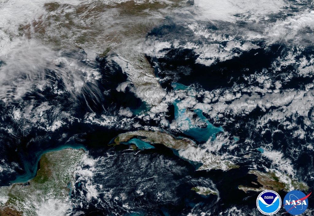
GOES-16 captured this image of the Caribbean and Florida. Here the satellite captures the shallows waters of the Caribbean. Credits: NOAA
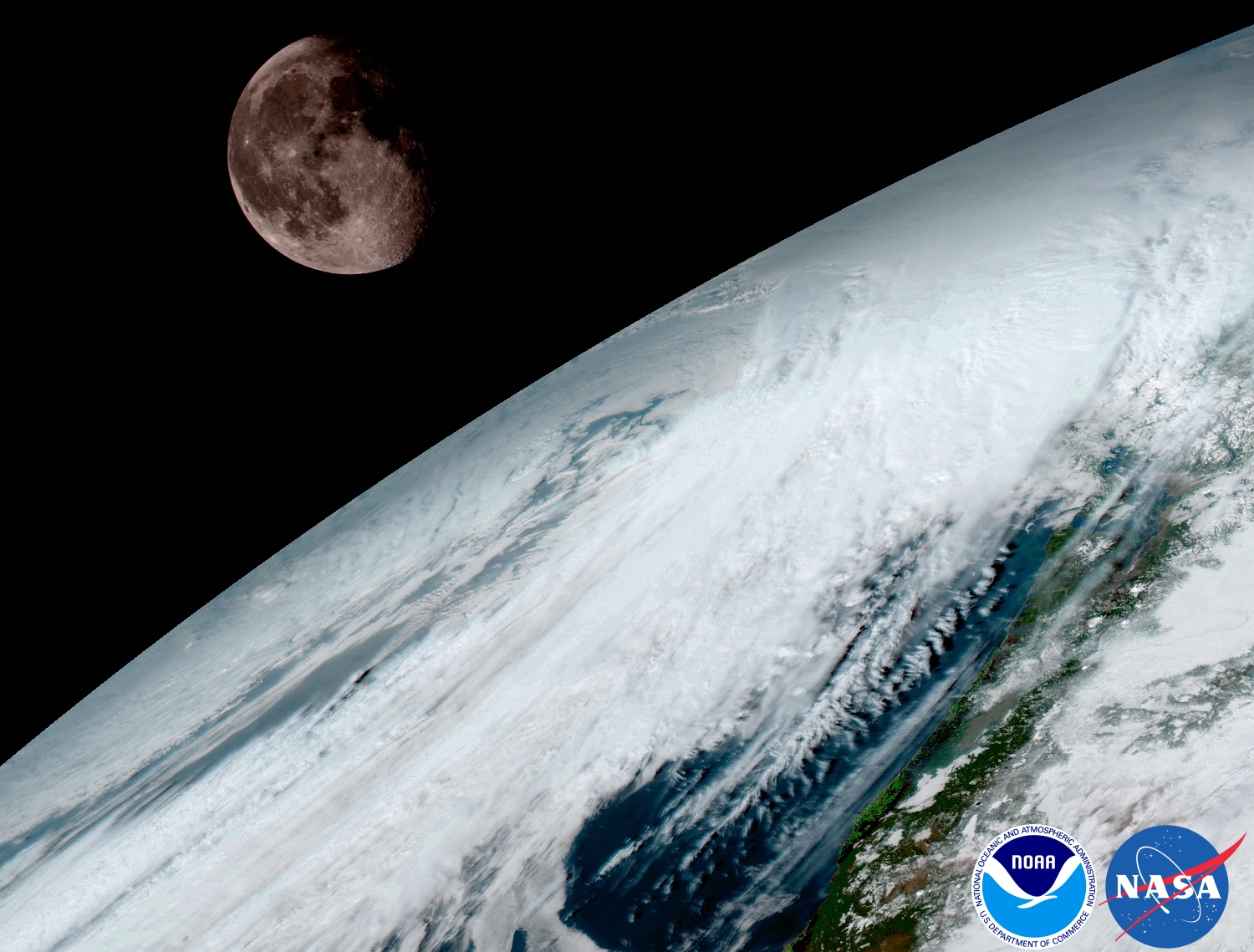
GOES-16 captured this view of the moon as it looked across the surface of the Earth on January 15. Like earlier GOES satellites, GOES-16 will use the moon for calibration. Credits: NOAA
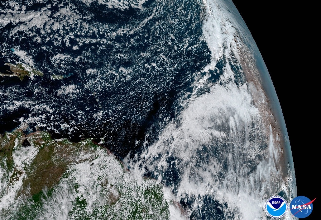
Dust Off the Coast of Africa, Jan 15, 2017. The Saharan Dust Layer can be discerned in the far right edge of this image of Earth. This dry air from the coast of Africa can have impacts on tropical cyclone intensity and formation. GOES-16’s ability to observe this phenomenon with its 16 spectral channels will enable forecasters to study related hurricane intensification as storms approach North America. These additional channels will also enable forecasters to differentiate between clouds from dust, or snow from clouds. Credits: NOAA

